
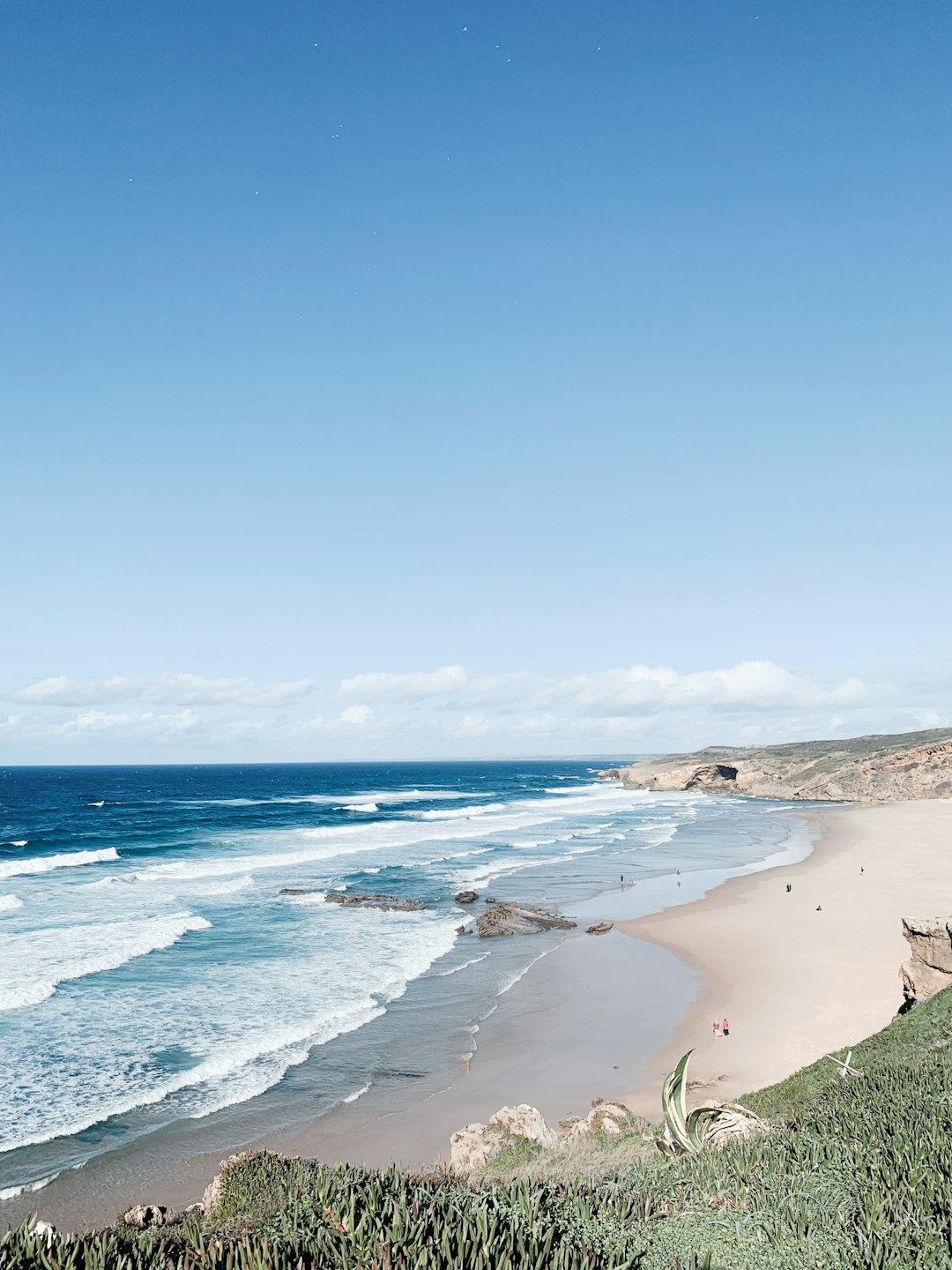
Praia da Arrifana sits at the bottom of a steep-sided cove on the Costa Vicentina, surrounded by dramatic black cliffs that frame one of the most photographed beaches in the western Algarve. The drive down from Aljezur takes about 15 minutes on a winding road that reveals the Atlantic in pieces: first a glimpse of blue, then the full bowl of the bay with its cliffs and golden sand. It is one of those beaches that looks different in every season, which is reason enough to understand it properly before you arrive.
The beach sits within the Costa Vicentina Natural Park, which means it is protected from the worst of the development that has reshaped the rest of the Algarve coast. There are no high-rise hotels on the cliff tops. There is no boardwalk of tourist shops. What there is: a small cluster of houses above the beach, a couple of surf schools and guesthouses, a 16th-century fort watching over the northern end of the bay, and the sense that the coast here has not yet been completely solved by tourism.
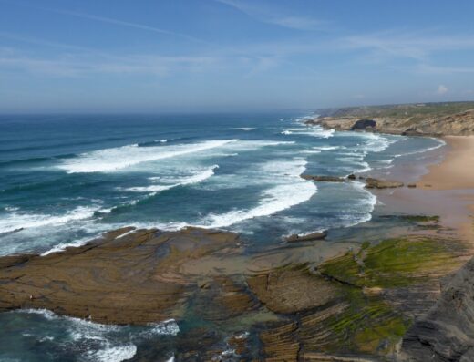
In winter and early spring, Praia da Arrifana often feels like a different beach entirely. The Atlantic swell that makes it famous with surfers in autumn and winter can make the bay feel raw and dramatic: waves breaking against the northern cliff, spray visible from the cliff top, the sky and sea in the same grey register. Photographers favour the winter months specifically for this intensity.
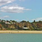
From April onward, the Atlantic calms and the water becomes progressively more swimmable. Sea temperature reaches approximately 17°C by late May and 19°C by July. This is comfortable for a 20-to-30-minute swim for most people. The beach widens considerably in summer as the sand builds, revealing a long sweep of golden sand that winter storms reshape.
The summer months bring the surf schools and the families. The atmosphere changes: it becomes more social and lively. If you want the version of Arrifana that feels like a discovery, May or early June delivers the same landscape with far fewer people.
One of the things that makes Arrifana significant, and that most visitors don’t realise until they arrive, is that it sits directly on the Fishermen’s Trail, the coastal path that forms stage 7 of the Rota Vicentina’s southern section. Coming from Aljezur to the south, the trail descends to the beach and passes through the village before continuing along the cliff top toward Carrapateira. This means that even if you are only visiting Arrifana for a half-day, you are sharing the space with walkers who are mid-route on a multi-day trek. The trail is clearly waymarked with blue and yellow paint marks, and anyone with an hour to spare can walk a section of it in either direction: north toward the cliffs above the bay, or south toward Monte Clérigo.
If you want to extend the Arrifana visit into a longer walk, the section from Arrifana to Monte Clérigo (approximately 5 kilometres each way, allow two to three hours) is one of the finest coastal walks in the western Algarve. It follows the cliff top throughout, with views back to the Arrifana bay from elevated angles that most visitors never see.
The beach has two distinct characters depending on conditions. On calm days (most common from May through September), the southern section of the bay is sheltered and relatively safe for weaker swimmers, with a gradual slope into the water. The northern end facing the Atlantic is more exposed and hosts the beach breaks that make the spot popular with surfers in autumn and winter.
For surfers, the optimal season runs from October through March, when Atlantic swells arrive consistently from the north and west. Summer surf is considerably smaller and more suited to beginners on soft boards. Surf schools operate at the beach from approximately April through October. For swimmers, the water is at its most pleasant from June through September. UV protection is essential at all times of year: the bay faces south-southwest, which means the sun enters the cove from mid-morning and stays until mid-afternoon, leaving limited shade on the sand after 10 am in high summer.
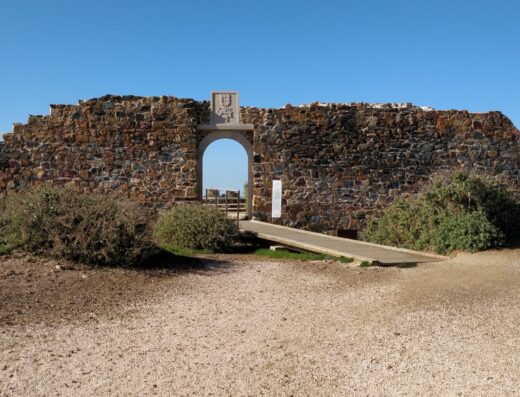
The Forte de Arrifana (sometimes called the Forte de São Luís) sits at the northern end of the bay on a rocky promontory. Built in the 16th century to protect the coast from Barbary pirate raids that were common along this stretch of the Atlantic, it is one of the more complete examples of a small coastal fortification in the western Algarve. Its walls and battlements still overlook the bay, and the interior is open to visitors without charge during daylight hours.
The fort adds a historical dimension to the beach visit that most Algarve beaches lack. Standing on the ramparts, you are looking at the same view that the soldiers watched for raiders: the same bay, the same cliffs, the same Atlantic approach. The contrast between this and the surf schools on the beach below is unexpectedly dramatic.
There are public toilets and an outdoor shower at the beach level. A small kiosk near the beach sells drinks, ice creams, and basic snacks during the summer season. For a proper meal, the restaurant at the Arrifana village above the beach offers seafood at prices significantly lower than equivalent coastal restaurants further east. The beach is not accessible for wheelchair users due to the steep descent. Dogs are not permitted on the beach between May and September, which is standard for Portuguese coastal beaches.
The Atlantic swell at Arrifana can change rapidly, particularly on the northern exposed section. Always check the beach flag status on arrival: red and yellow flags indicate supervised swimming areas. The lifeguard station operates from June through September. Outside these months, there are no lifeguards. If walking the Fishermen’s Trail in wet weather, the cliff-top path between Arrifana and Monte Clérigo can be slippery: poles are recommended in winter and early spring. The IPMA marine forecast should be checked before any water activity.
About This Spot
-
General AreaNear Aljezur, Algarve
-
Coverage BadgeArchive
-
Best SeasonWinter
-
Difficulty2 Moderate
Getting There & Access
-
Getting ThereFrom Aljezur, take the M506-1 road south for approximately 6 kilometres. The road descends steeply into the coastal bowl, with several hairpin turns. There is no public transport directly to the beach; the nearest bus stop is in Aljezur, from where a taxi or bicycle is required for the final 6 kilometres. The descent from the cliff-top car park to the beach is on a steep but well-maintained concrete path; allow 10 to 15 minutes down. The return is correspondingly steeper: allow extra time and carry water, particularly in summer heat.
-
Access TermsFree Public
-
ParkingCliff-top car park, approximately €2 to €3 for a full day. Fills quickly. Arrive before 10 am on weekends and public holidays in spring and summer.
-
Crowd LevelVaries
Photography Notes
-
Shooting NotesWinter drama is the signature: waves breaking against the northern cliff with spray visible from the cliff top. The cliff-top trail toward Monte Clérigo gives elevated angles over the bay most visitors never see; the 16th-century fort on the northern promontory adds a framing subject.
-
Light & Sun NotesPhotographers favour the winter months for the raw, grey-register intensity. The bay faces south-southwest: sun enters the cove from mid-morning and stays until mid-afternoon, leaving limited shade after 10 am in high summer.
-
ConditionsAtlantic swell can change rapidly, especially on the exposed northern section. Calm days most common May–September; consistent north/west swells October–March. Lifeguards June–September only — check beach flags and the IPMA marine forecast. Cliff-top path slippery in wet weather.
Visitor photos


Location
Log in free to see the exact pin and directions.

Leave a Reply
Been here? Add your shots.
Photos you add appear on this page with your name on them, next to the community gallery. Tell the next photographer what you found: the light, the crowds, whether it was worth the trip.
A free account also unlocks the exact pin, how to get there and the best time of day, on every spot.