Rocha da Pena After the First Autumn Rain: When to Walk the 6.7 km Plateau Loop, and When to Wait
Photo: Portuguese_eyes · Flickr · CC BY-SA 2.0
The first autumn rain can make Rocha da Pena feel cooler and clearer, but it can also turn the exposed limestone on PR18 LLE into the deciding factor between a satisfying 6.7 km circuit and an avoidable fall. The practical answer is simple: check three things before committing to the plateau. Look at the temperature during your walking hours, the forecast wind and gusts, and whether the rock has dried to a pale, matt surface.
If all three are favourable, complete the loop. If the plateau is windy or still damp but the lower ground is firm, take a short out-and-back walk below the escarpment. If the limestone has a wet sheen, water is running across the path, or stronger gusts are forecast, postpone the route. Rocha da Pena is near Salir in the municipality of Loulé, so save it for a dry morning.
PR18 LLE at a glance
| Detail | What to expect |
|---|---|
| Location | Near Salir, in the municipality of Loulé |
| Official distance | 6.7 km, circular |
| Official walking time | About 2 hours |
| Sensible time allowance | 2.5 to 3 hours, including viewpoints and cautious footing |
| Elevation gain | 285 m |
| Altitude | Approximately 310 m to 479 m |
| Highest point | Talefe, at 479 m |
| Difficulty | Advanced, with steep pulls on loose stone and full exposure on the plateau |
| Start and finish | Trailhead and small parking area in Penina, between Salir and Alte |
| Trailhead access | Signed off the local road at Penina |
| Parking and access | Small parking area at the trailhead; free public access to the route |
The current official PR18 LLE route listing gives 6.7 km, two hours and 285 m of ascent. Older guides sometimes show shorter distances, so use the current route file or the red-and-yellow PR markings rather than building a plan around an old figure.
The decision table for tomorrow morning
These are practical thresholds for an exposed limestone walk, not formal closure rules. Conditions at the trailhead still take priority over an app.
| Decision | Temperature | Wind | Rock and path condition |
|---|---|---|---|
| Complete the 6.7 km loop | About 12°C to 24°C during the walk | Sustained wind below 20 km/h, gusts below about 35 km/h | Limestone looks pale and matt, shoes grip on the first rocky section, no runoff |
| Stay on the lower paths | About 10°C to 25°C | Sustained wind around 20 to 30 km/h, or gusts around 35 to 45 km/h | Lower dirt is firm, but exposed slabs remain damp or the plateau is receiving cloud and wind |
| Postpone | Above 26°C during most of the outing, or cold combined with rain and wind | Gusts above about 45 km/h on the plateau | Wet sheen, greasy mud, running water, fresh loose debris, active rain or another shower likely before you finish |
Wind is more important here than the modest altitude suggests. The route approaches an unfenced escarpment and crosses open ground where a gust can affect balance. Published mountain-walking guidance notes that buffeting begins to affect balance around 30 to 40 km/h and advises avoiding exposed ridges as wind strengthens. Portuguese trail-safety guidance also says not to set out in heavy rain, fog or strong wind. On Rocha da Pena, using 45 km/h gusts as a reason to stay off the plateau is a sensible conservative line.
Why the first autumn rain changes this walk
After a dry Algarve summer, the first rain does more than wet the surface. It mixes with accumulated dust, fine soil and plant material. On compacted earth that can produce a greasy film. On smooth limestone it reduces the reliable friction you had in dry conditions.
- The opening climb matters first. PR18 begins with a sharp rise on dirt and stone. If your feet slide here, the higher limestone will not be an improvement.
- Polished steps stay damp. Hollows and shaded rock can remain wet after surrounding soil appears dry.
- The plateau is exposed. Wind speeds can be higher on the top than beside the parked car.
- The southern edge deserves space. Do not walk close to the cliff merely to avoid puddles or mud on the marked line.
- Heavy rain can loosen material. The official route information warns of possible slips and falling stones or blocks on the slopes. Do not linger beneath the escarpment if you see fresh debris.
A sunny forecast does not guarantee dry rock at 08:00. A cool, still, humid night can leave shaded sections damp well into the morning. Conversely, several hours of sun and a light drying breeze may make an afternoon walk more suitable than an early start.
A two-stage check before you commit
Check the forecast at home
Look at the hourly forecast for Salir or Rocha da Pena, not only the daily icon for coastal Algarve. Check the hours covering your drive, walk and a 60-minute delay.
- Read the probability and timing of rain, not just the total millimetres.
- Check gust speed as well as average wind.
- Note the wind direction. A crosswind is more awkward near an exposed edge than a steady headwind on a broad path.
- Use the temperature expected between your start and finish, not the overnight minimum.
- If there is a weather warning, Civil Protection notice or temporary trail closure, postpone.
Check the ground at Penina
Spend five minutes testing conditions before leaving the trailhead. This is more useful than trying to preserve a plan made at breakfast.
- Walk onto the first stony incline without stepping off the marked path.
- Look for a reflective sheen on limestone and dark moisture in cracks.
- Press and twist one boot gently on a low, flat stone. Do not test grip near an edge.
- Check whether mud is sticking to the tread and making the sole smooth.
- Watch vegetation on the upper rim. Continuous bending and shaking can reveal stronger wind above.
- Listen for water and look for fresh stones below the escarpment.
If the first climb feels uncertain, turn around there. This advanced route becomes more demanding when every foot placement requires correction.
Option 1: Complete the full plateau loop
Choose the complete PR18 LLE when the limestone is dry, visibility is good and the forecast stays comfortably within your wind and temperature limits. The marked route is normally followed counterclockwise.
- Climb from Penina. The steep opening section gains height quickly on dirt and stone. Set a measured pace rather than treating the official two-hour time as a target.
- Reach the plateau. The gradient eases. A signposted spur leads toward the northern viewpoint, but it is optional if cloud or wind has increased.
- Cross the open top. The route runs through low vegetation and in places follows the southern side of the plateau. Keep to the marked trail and give the cliff edge generous space.
- Pass the old wall and Talefe. Talefe is the high point at 479 m. It is also a useful final weather check before the descent.
- Descend from the plateau. Wet, loose or leaf-covered stone may require more attention on the descent than on the climb.
- Return to Penina. Follow the marked lower section back to the trailhead and parking area.
Two hours is possible for a steady walker who keeps moving. After rain, allow closer to three hours. Shorter steps, pauses to assess the surface and a slower descent are sensible, not signs that anything has gone wrong.
Option 2: Keep the outing low
A lower-path walk is useful when the plateau is windy or still visibly damp but there is no active rain, the soil below is firm and no fresh debris is present. It is not an official shortened circuit. Treat it as an out-and-back so that you do not invent a connecting route across protected vegetation or private ground.
- From Penina, follow the marked lower section only as far as conditions safely allow.
- Set a turnaround time before leaving. Thirty minutes out and thirty minutes back usually produces a walk of roughly 2.5 to 3 km, depending on pace and exactly where conditions make you turn.
- Remain below the plateau rather than climbing onto wet slabs to improve the view.
- Turn back immediately if the rustic path becomes greasy, waterlogged or covered by fresh stone.
- Do not shelter directly beneath an overhang or cliff after heavy rain.
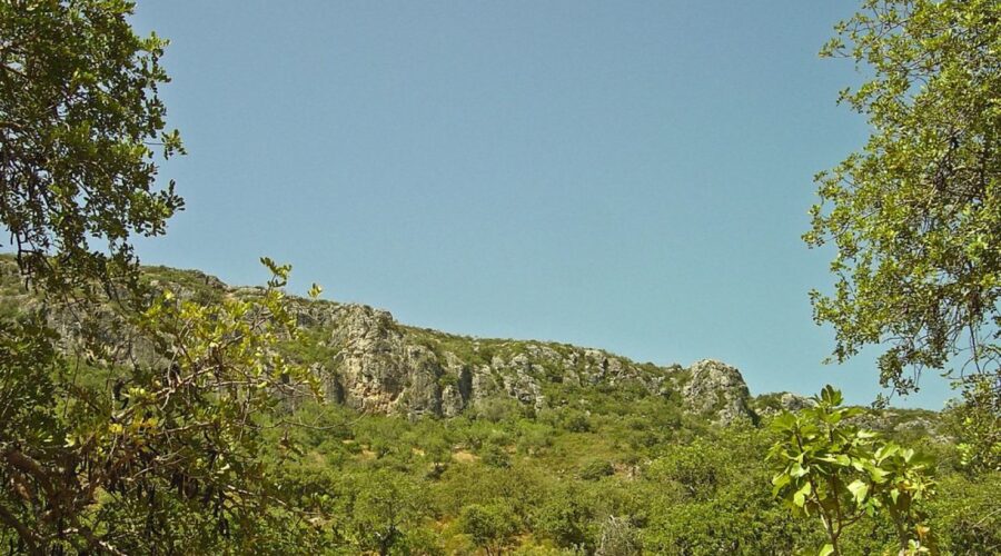
This option still gives a close view of the limestone face, Mediterranean scrub and the scale of the plateau. It also keeps the car within a manageable return distance if another shower arrives.
Option 3: Wait for the rock to dry
Postponing is the right decision when the risk comes from several conditions at once. Typical combinations include wet limestone with gusty wind, low cloud with poor visibility, or a warm forecast that would place most of the exposed crossing above 26°C.
Do not assume one rain-free hour is enough. After overnight rain, consider a later start only if:
- the rain has stopped completely;
- the forecast remains dry for the whole walking window;
- the plateau is out of cloud;
- sun or a light breeze has had several hours to dry the surface;
- the first rocky climb passes the boot-grip test.
If those conditions are not met, return on the next dry day. The route is a free public space.
Temperature changes the best starting time
| Forecast high | Practical timing |
|---|---|
| Below 18°C | Late morning can allow overnight moisture to dry. Carry a wind layer for the plateau. |
| 18°C to 23°C | A morning start after the rock has dried is usually comfortable. |
| 24°C to 26°C | Start early only if the surface is already dry, or wait for a cooler day. Much of the top lacks shade. |
| Above 26°C | A lower walk may still become hot. Postpone the full loop unless your entire outing fits into cooler hours. |
Starting at dawn is not automatically safer after rain. You may exchange heat for damp limestone. In mild autumn weather, 09:30 or 10:00 can be the better start if sunrise, temperature and a drying breeze have removed the overnight moisture.
Getting there, parking and crowds
The classic loop starts from the hamlet of Penina, between Salir and Alte, near Salir in Loulé municipality. Check your route and current driving time before leaving, as inland roads and traffic affect the journey.
Use the local road between Salir and Alte and take the signed turn for Penina. The waymarked circuit and small parking area begin there.
- The parking area at the trailhead is small.
- Access to the trail is free and public.
- Arrive earlier on a dry Saturday or Sunday.
- Weekday mornings outside holidays are often quiet.
- Good autumn weekends feel local rather than empty, with walkers and climbers sharing the access area.
- Do not block the road, gates or turning space if the marked area is full.
What to pack for an autumn decision day
- Walking shoes with deep, clean tread. Smooth trainers are a poor match for wet limestone.
- At least 1 litre of water per person in cool conditions, and 1.5 litres if temperatures approach 24°C.
- A light waterproof and a separate wind-resistant layer.
- A downloaded GPX or offline map. The official route page provides GPX and KML files.
- A charged phone, plus a small power bank if using it for navigation.
- A basic first-aid kit and any personal medication.
- Sun protection, even after rain. The plateau is exposed.
- A small bag for all litter. Remain on the marked path within the protected landscape.
Tell someone where you are going and when you expect to return. For an emergency in Portugal, call 112.
The practical call
For tomorrow, choose the full 6.7 km circuit only when the plateau is dry, the walking temperature remains roughly between 12°C and 24°C, and gusts stay below about 35 km/h. Choose a timed lower-path out-and-back when the ground below is firm but exposed limestone remains damp or plateau gusts may reach 35 to 45 km/h. Postpone when the rock shines with water, mud coats your tread, rain may return, visibility is poor or gusts exceed about 45 km/h.
The first autumn rain often improves the colour, clarity and temperature at Rocha da Pena. It does not create an obligation to climb. Let the rock decide whether this is a plateau day, a short lower walk or simply a reason to come back after another dry morning.