Sagres Beyond the Fortress: What the Western Tip Actually Has
Photo: Kolforn · Wikimedia Commons · CC BY-SA 4.0
Most visitors to Sagres drive out to the fortress, stand at the edge of the headland, take a photograph, and leave. That is a reasonable short visit, but it misses the coves, public viewpoints, and walking paths around Sagres.
Sagres is small, exposed to Atlantic weather, and practical rather than polished. Its appeal comes from three things close to one another: the headland, the coves, and the network of coastal paths.
This is a two day guide. With one afternoon, visit the fortress, walk around its headland, and choose one cove. With two full days, add a surf beach, the harbour area, and a short section of the Rota Vicentina.
Day one: the fortress and the headland
The Fortress of Sagres
The fortress occupies the Ponta de Sagres promontory, near Praia da Mareta. Its present appearance reflects several periods of construction and reconstruction, while the headland itself has a much longer history of human use.
The main features inside the walls include:
- The wind rose: a large stone pattern set into the ground. Its original purpose remains debated.
- The cistern: a vaulted water collection structure beneath the site.
- The chapel: a small building that can be included in a circuit of the grounds.
- The walls and headland: the paths provide open views across the Atlantic and the surrounding coast.
Opening hours and tickets: Hours and admission prices can change. Confirm both through the official heritage service before visiting. Plan enough time to walk the grounds without rushing.
Parking at the fortress: Public parking is available outside the entrance. It can fill during busy periods, so an earlier arrival gives you more flexibility.
The Ponta de Sagres circuit
Paths within the fortress grounds continue around the promontory and pass the Ponta de Sagres lighthouse. The surface is exposed and stony in places, with low vegetation and little shelter from the wind.
The lighthouse itself is not a public visitor attraction. The practical reason to follow the circuit is the sequence of clifftop viewpoints across the open Atlantic. Keep back from cliff edges, particularly in strong wind or poor visibility.
Smaller coves and rock formations are visible from parts of the route. Conditions below can change quickly when the Atlantic swell increases.
Day one, late afternoon: Mareta or Beliche
After the fortress, choose one of two beaches rather than trying to treat them as a single stop.
Praia da Mareta
Praia da Mareta faces the southern side of Sagres and can be more sheltered than beaches exposed directly to the Atlantic. Swimming still depends on the conditions that day.
Praia do Beliche
Praia do Beliche is on the exposed coast between Sagres and Cabo de São Vicente. It is used by surfers when conditions suit. Access involves a descent from the clifftop parking area, so consider the return climb before heading down.
The beaches are in different locations. Check the route and current access conditions before setting out.
Day two: public spaces and the surf coast
Sagres is in Vila do Bispo municipality on the western Algarve coast. The settlement has a small permanent community and a functional layout. A slow visit works best if you focus on public spaces rather than trying to fill a checklist.
Public places to include:
- The harbour area: a working part of Sagres where you can observe the town’s maritime activity without entering restricted operational areas.
- The main square: a useful point for orienting yourself before walking through the town.
- The church near the square: a simple stop if it is open and you are passing.
Praia da Baleeira
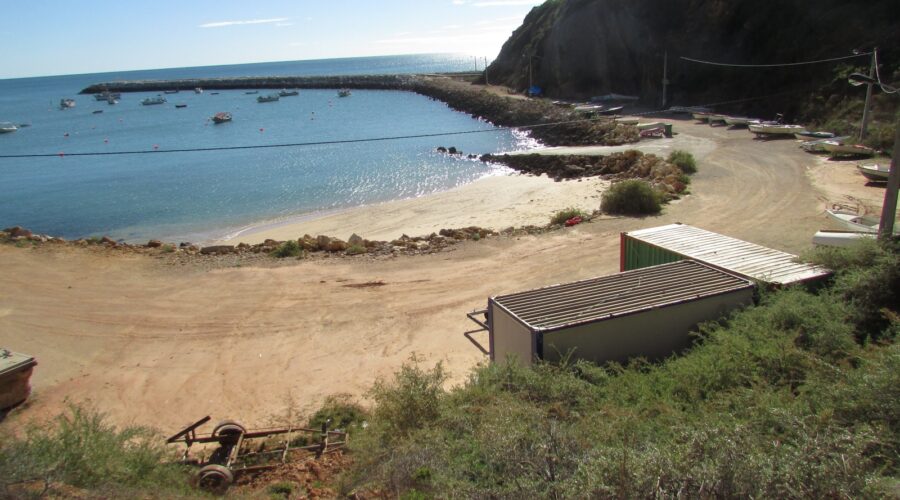
Praia da Baleeira is the town beach beside the harbour area. Its position can offer more shelter than the beaches facing the open Atlantic, but water safety depends on daily conditions. Parking becomes more difficult during busy summer periods.
The Rota Vicentina connection
The Fishermen’s Trail section near Sagres provides an option for a short coastal walk without committing to a full stage. Check the official route information, weather, trail status, and turnaround point before leaving.
Getting there and practical logistics
Sagres is in Vila do Bispo municipality on the western Algarve coast. From Lagos, use a current route planner or local transport information, since road conditions and journey times vary.
By bus: Regional services connect Lagos and Sagres. Timetables vary by season and day of the week, so check the current schedule and journey time before travel.
By car: Follow the current signed route to Sagres. During busy periods, public parking near the fortress and beaches can fill earlier in the day.
Weather and wind: Sagres is exposed to Atlantic wind. Conditions on the headland can be stronger than they appear in town, and rough water can make swimming unsafe. Check local warnings and beach flags before entering the water.
How two days here compares with two days in Lagos
If you are deciding where to spend two days, compare the places by access, walking conditions, beaches, and the amount of town infrastructure you need.
| Factor | Sagres | Lagos |
|---|---|---|
| Fortress access | Located at the edge of town | Requires a separate trip to Sagres |
| Headland walks | Exposed coastal paths with limited shelter | Popular paths around the Lagos headlands |
| Beaches | Mareta, Beliche, and Baleeira offer different levels of Atlantic exposure | Several beaches sit close to the urban area |
| Town atmosphere | Small settlement with limited visitor infrastructure | Larger town with more services and activity |
| Rota Vicentina access | Direct access to nearby trail sections | Requires travel toward the western coast |
| Wind exposure | High on the headlands and open coast | Varies by beach and headland |
Choose Sagres if your priorities are exposed coastal landscapes, walking, and a quieter schedule. Choose Lagos if you need a larger town, more services, and a wider choice of activities within the urban area.
Bottom line
The fortress and its headland circuit form the core of a short visit. Add either Mareta or Beliche according to the day’s wind, swell, and access conditions. A second day can cover the harbour area, Praia da Baleeira, and a manageable section of the Rota Vicentina.
Sagres works best as a destination for public coastal spaces: the promontory, cliff paths, beaches, harbour, and Atlantic conditions. Check official opening information, transport schedules, trail status, and beach warnings before setting out.