
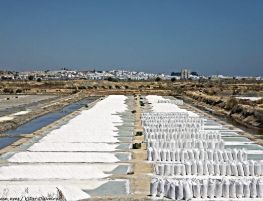
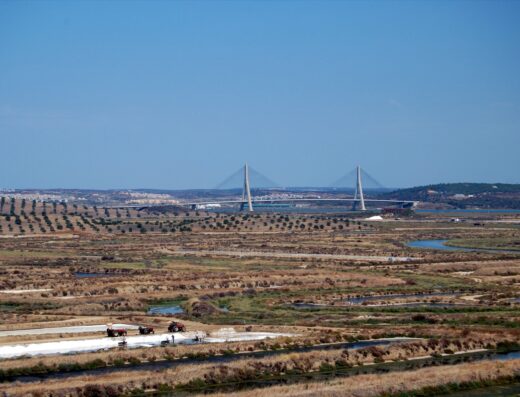
Flat country makes low hills valuable. The salt-pan territory around Castro Marim barely rises above sea level, so the modest mound at Espargosa earns its place on the map by doing one thing well: lifting you just high enough to read the salinas as pattern instead of a wall of dykes. From the rise, the pans resolve into a patchwork: rectangles of white, rose and olive stitched together by dark earth walls, running toward the river and the sea.
This is a viewpoint in the plainest sense. There is no drama in the landform itself: the interest is entirely in what lies below and how the light hits it. Treat it as one stop on the salt-country circuit: the working pans, the marsh reserve and the castle hill all sit within easy reach of one another. A mid-range zoom that lets you pick sections of the pattern will do more for you here than forcing the whole sweep into one frame.
When to go: low sun, early or late, when the dyke walls throw shadow and the patchwork gains relief. After winter rain the colours run deeper; in late summer the harvest mounds add white punctuation. Midday flattens the whole scene into glare.
Who it’s for: photographers already working the Castro Marim salinas who want the map view without flying for it, and anyone who has seen aerial shots of the pans and wondered where to stand instead.
About This Spot
-
General AreaNear Castro Marim, Castro Marim
-
Coverage BadgeArchive
-
Difficulty2 Moderate
Getting There & Access
-
Access TermsFree Public
-
Crowd LevelQuiet
Photography Notes
-
Shooting NotesThe draw is the elevated read of the salt-pan patchwork: dyke lines and coloured pans as pattern rather than landscape.
-
Light & Sun NotesLow sun throws the dyke walls into shadow and gives the patchwork relief; midday flattens it.
Visitor photos


Location
Log in free to see the exact pin and directions.
Leave a Reply
Been here? Add your shots.
Photos you add appear on this page with your name on them, next to the community gallery. Tell the next photographer what you found: the light, the crowds, whether it was worth the trip.
A free account also unlocks the exact pin, how to get there and the best time of day, on every spot.