
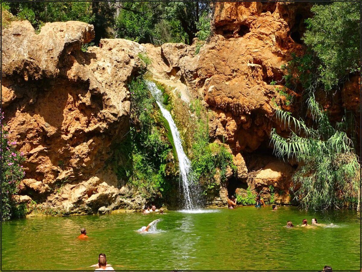
Pego do Inferno sits inland from Tavira, in a greener pocket of the eastern Algarve where water and shade linger longer than on the exposed coast. The site is known for a small waterfall and pool setting inside a narrow valley, with limestone walls and riparian vegetation creating a noticeably cooler microclimate.
This is not a high-volume beach destination. It is a short nature outing: dirt-track access, a compact walking approach, and a shaded river pocket that feels very different from the coast. In spring, the area is at its best: active flow, birdsong, and moderate temperatures.
A practical half-day plan is Tavira old town at sunrise, then Pego do Inferno mid-morning for the shaded walk. This gives a culture-plus-nature split without long transfers.
Flow varies year to year depending on winter rain. After dry winters, waterfall volume can be reduced by late spring. After wet winters, the pool and stream sections remain active longer into May.
The final approach can be slippery and uneven, especially after rain. Wear closed shoes with grip, avoid edge scrambling near wet rock, and do not attempt cliff jumps: depth and submerged rock are inconsistent.
About This Spot
-
General AreaNear Santo Estêvão, Tavira
-
Coverage BadgeArchive
-
Best SeasonSpring
-
Difficulty2 Moderate
Getting There & Access
-
Getting ThereFrom Tavira, about 15 to 20 minutes by car depending on route: rural roads, then dirt-track access and a short walk-in path to the waterfall and pool.
-
Access TermsFree Public
-
ParkingLimited and informal; arrive early on weekends.
-
Best TimeMorning
Photography Notes
-
Shooting NotesSmall waterfall and pool framed by limestone walls and riparian vegetation inside a narrow valley, a shaded river pocket unlike anything on the coast.
-
Light & Sun NotesShaded valley with a noticeably cooler microclimate; morning or late afternoon avoids peak heat.
-
ConditionsFlow depends on winter rain: reduced by late spring after dry winters, active into May after wet ones. Final approach slippery after rain; no cliff jumping: depth and submerged rock are inconsistent.
Visitor photos


Location
Log in free to see the exact pin and directions.



Leave a Reply
Been here? Add your shots.
Photos you add appear on this page with your name on them, next to the community gallery. Tell the next photographer what you found: the light, the crowds, whether it was worth the trip.
A free account also unlocks the exact pin, how to get there and the best time of day, on every spot.